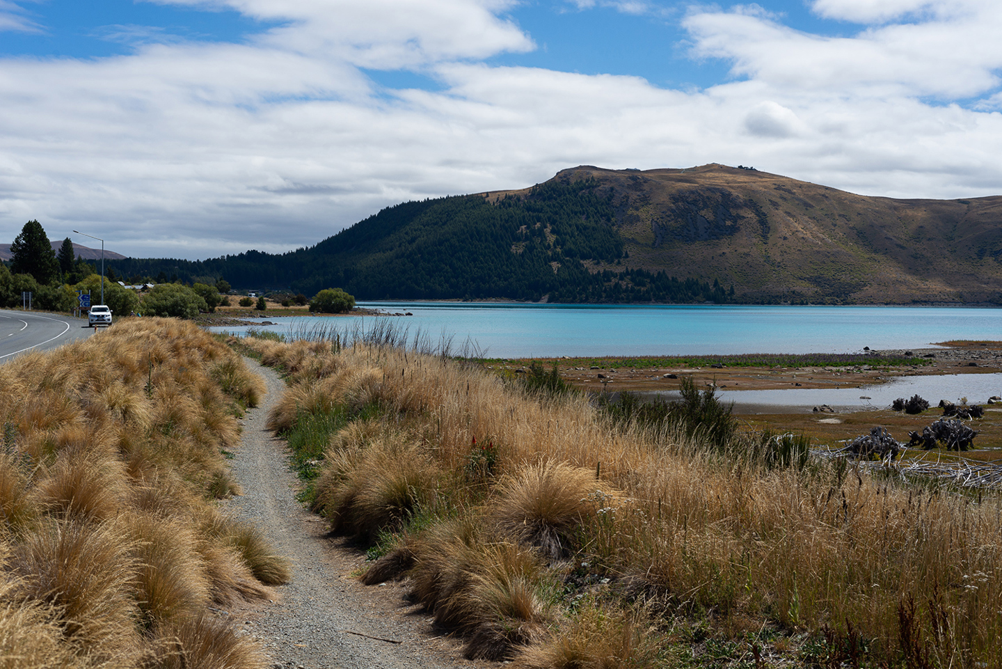
Lake Tekapo/Takapō township (Source: Sam Lord, 2021)
I still remember the first time I drove in to Lake Tekapo/Takapō. Rounding the last corner of SH-8 and my first glimpse of the turquoise water. Progressing further, I couldn’t help stopping off at the Church of The Good Shepherd – even before I’d dropped by my home-to-be and met my new landlord. The Southern Alps served as an imposing backdrop to the petite Mount John, whose summit I had yet to climb but where I was planning to work for the following 6 months.
Lake Tekapo/Takapō township (Source: Sam Lord, 2021)
Flash forward three years and I still can’t believe my luck! Gazing out at the lake and mountains through my lounge window is something I’ll never grow accustomed to, but as I’ve settled down and these views have become part of my daily life, I’ve begun to wonder.
Most people are aware that New Zealand experiences earthquakes. The sympathies of the world were cast New Zealand’s way following the Christchurch earthquake in 2011, and I experienced my first earthquake whilst in Wellington, on my way down to Lake Tekapo/Takapō.
But when the natural beauty of the country is so spectacular, the risks associated with this type of landscape tend to fall to the back of the mind. On the North Island we enjoy a subtropical climate and white sandy beaches. The southern landscape was carved by glaciers.
What the two islands have in common, though, is that they both lie on the Pacific Ring of Fire, a geographical area known for its significant earthquake and volcanic activity.
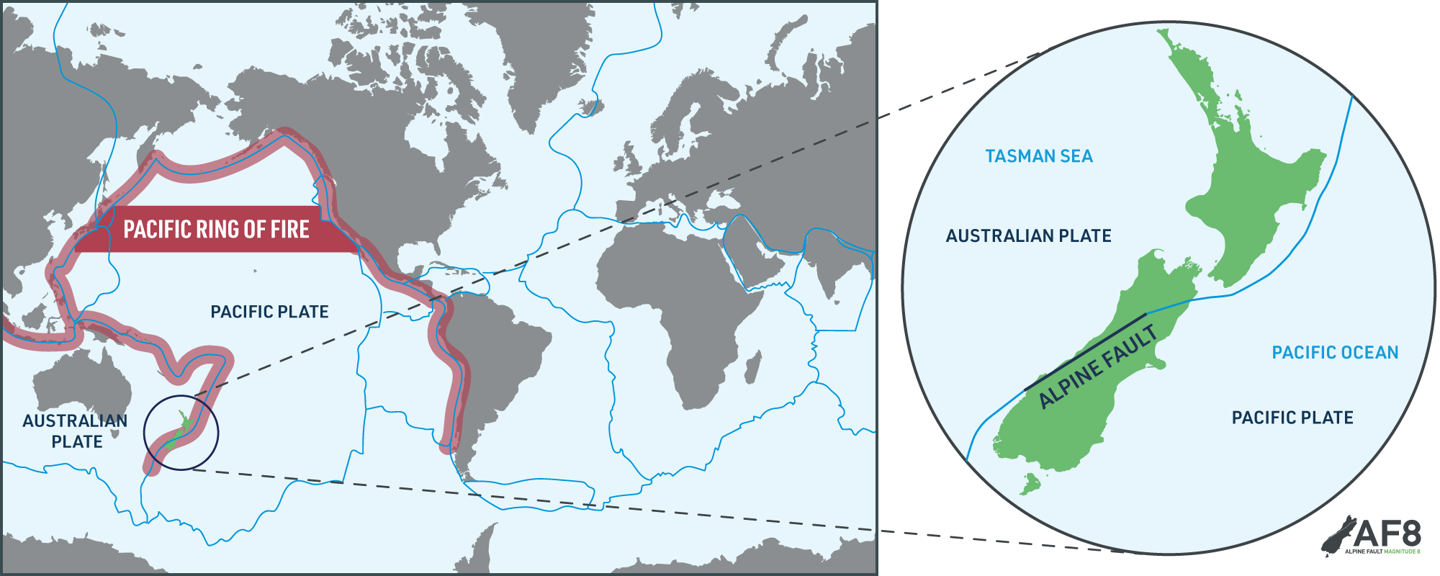
Aotearoa New Zealand sits at the boundary of the Pacific and Australian Plates, at the South-West corner of the Pacific Ring of Fire.
On the east coast of the North Island, the Pacific plate dives underneath the Australian plate, forming the Hikurangi subduction zone. The Alpine Fault runs up the spine of the South Island, along the west coast. Its movement along the Alpine Fault over millions of years that have formed the Southern Alps.
The Alpine Fault was discovered by a geologist named Harold Wellman. In 1941, he spent 6 months adventuring down the west coast of the South Island with his colleague, Dick Willett.
They were looking for a fault depression forms as when rock is ground down due to movement across a fault. The material at the boundary that has fractured and shattered is eroded more easily than the surrounding rock, causing a depression. Wellman and Willett combined the observations they’d made during their journey with existing geological records and pieced the puzzle together, concluding that there was one primary fault extending for hundreds of kilometres up the South Island.
It’s quite mind-boggling to think that discovery was only made within the last 80 years, and only within the last 40 years that the theory of plate tectonics has become accepted.
Visitors from far and wide travel to New Zealand to enjoy these awesome landscapes, we don’t often stop to consider how these unique geological features formed. We can’t turn back time and see the formation of the mountains, so how can we understand the sequence of events that led to what we see today?
My interest in this subject was sparked after I attended an AF8 Roadshow talk in 2019. The experts explained that, in certain, places streams and rivers cross the Alpine Fault. When there is movement across the fault due to an earthquake, the flow of the rivers is often disturbed, and this impacts the layering of sediment that they deposit.
By assessing the layering of rock at particular sites along the Alpine Fault, we can see records of earthquakes extending back over the last 8000 years. From what they’ve seen, earthquakes have occurred on the Alpine Fault on average every 300 years, and the last was in 1717AD.
But it’s not only tectonic activity that’s shaped the South Island of New Zealand. The combination of mountains and lakes is a result of both tectonic and glacial activity.
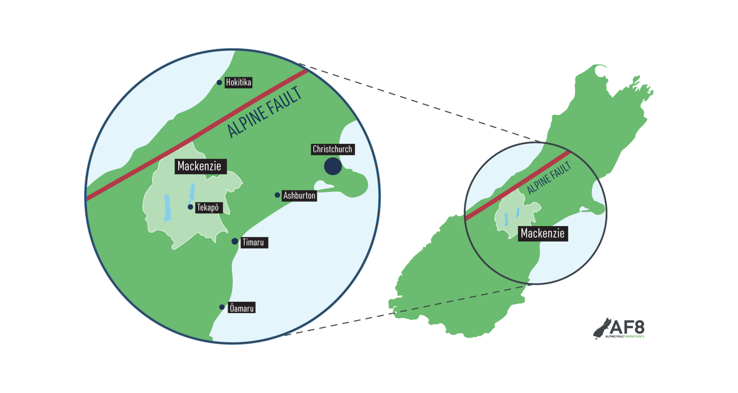
The Mackenzie District is located in South-West Canterbury in the South Island of New Zealand.
During the last ice age, the whole Mackenzie Basin, where I live, was covered in sheets of ice, kilometres thick. The glaciers carved away the earth beneath them and, when they retreated at the end of the ice age, they left large scale features like the lakes, but also finely ground rock called glacial flour. That material is now suspended in the water of lakes Tekapo/Takapō, Pukaki and Ōhau, and reflects a particular blue wavelength of light, giving the lakes their distinctive colour.
The evolution of our landscape isn’t just confined to the past – it continues today. We live in a dynamic environment. The ground shakes regularly, and the loose material that was deposited by those glaciers is prone to movement when earthquakes occur, meaning that landslides are a potential secondary hazard.
Then we must think about the lakes themselves: if you’ve ever jumped out of the bath too quickly, you’ll know about the sloshing that can happen when a volume of water experiences sudden movement! Imagine the movement of the enormous volumes of water in the South Island lakes in the event of a large Alpine Fault earthquake.
If I’ve been here for three years and I’ve not yet fully grasped the geological origins of the area and their implications, what of the other visitors, hundreds of whom pass through here daily? And how about the locals – they’ve been attracted to settle here permanently, but do they really understand the basis of the area’s appeal?
It’s impossible to predict exactly when an earthquake will strike, where it’ll happen, and what the outcome will be. But at the same time, it’s essential to be as prepared as possible for the eventuality, to protect ourselves, our families and our communities from harm.
Over the course of this series, I intend to find out more. I’ll start by learning about the use of earthquake scenarios to help us anticipate the possible outcomes of a large earthquake. Then, I’ll take a deeper look at the work that has been done to understand the potential hazards posed by the Mackenzie Lakes in the event of an Alpine Fault earthquake, and the methods used to explore their geology. I’ll finish off by exploring the impacts that a large earthquake on the Alpine Fault will have on the South Island, and the Mackenzie Lakes in particular, and – most importantly – how we can be as prepared as possible for an earthquake event, no matter where we live.
Although this investigation will be focused on my local area – the Mackenzie District – the take home messages are applicable wherever you live in New Zealand, and whether you’re a resident or a visitor.
I hope you’ll join me on my journey.