It stands for Alpine Fault magnitude 8. Geological studies have shown that an earthquake of this magnitude occurs on the Alpine Fault at regular intervals. AF8 has been set up to assess the impacts that the next such earthquake will have on South Island communities and infrastructure, help people understand and prepare for this inevitability, and develop a planning framework for a coordinated response.

The Alpine Fault is the on-land part of the boundary between the Australian and Pacific tectonic plates. It is a transform plate boundary, meaning the two plates grind past each other, although there is some compression and uplift as well – enough to have created the Southern Alps!
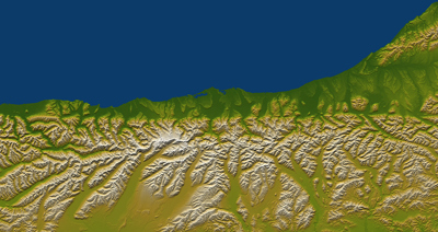
At its full extent the Alpine Fault runs for around 800km the length of Te Waipoumanu our South Island. It marks the western edge of the Southern Alps and the straightest part of the fault (500km) runs from John O'Groats at the entrance to Milford Sound in the south, to near Lewis Pass in the north.
Everything. The earth’s crust is divided into large pieces called tectonic plates which move around on a viscous layer beneath the crust called the mantle. These plates move and grind past, under and over each other in various ways to absorb tectonic movement on other parts of the globe. This movement isn’t smooth because friction causes the rock on the boundaries of these plates to snag and grab. Once enough tension builds up, movement will occur along a fault, releasing the built-up energy as an earthquake.
Around the globe, tectonic plate boundaries are where earthquakes are concentrated. You may have heard of the ‘Ring of Fire’? Well that is the edge of the Pacific plate, and it includes little old New Zealand.
Not anytime soon! The plate boundary that is located across New Zealand has existed for more than 20 million years. The relative motion between the Australian and Pacific plates today involves the Pacific plate moving south-west past the Australian plate, with some compression across the Southern Alps and this situation has been happening for around the last 5 million years.
These massive tectonic forces change and evolve through geological time, and it is highly likely that in future these forces will continue to change. However, human timescales are much shorter, so we are not likely to see any significant change within the lifetimes of New Zealanders.
The latest science tells us that there is an 82% (or 4 out of 5) chance that the next earthquake on the Alpine Fault will be Magnitude 8 or above. For comparison, the 2016 Kaikoura earthquake was magnitude 7.8 and the 2011 Christchurch earthquake was magnitude 6.3.
But the magnitude of an earthquake is only one way to measure the size of an earthquake. The intensity of shaking and ground movement is just as important and that varies according to proximity to the epicentre, the depth of the earthquake and the ground conditions where you live.
Whichever way you look at it, an Alpine Fault earthquake is likely to be bigger in magnitude, intensity and impacts than anything we’ve seen in our lifetimes.
Magnitude relates to the amount of seismic energy that is released by an earthquake. The impact an earthquake has on a region or community will also be influenced by its proximity to the earthquake rupture, and its vulnerability to earthquake-induced hazards, such as ground shaking, landslides, liquefaction, and tsunami, for example.
Intensity is a metric commonly used to refer to the amount of damage an earthquake causes to the built environment. It’s measured using the Modified Mercalli Intensity Scale.
As an example: A large earthquake which occurs in a remote location, or is deep beneath the earth’s surface may cause less damage to the built environment than a smaller but shallower quake that is located near a built-up area. The two Canterbury earthquakes of September 2010 and February 2011 illustrate this: the 7.1 magnitude earthquake of 4 September was centred near Darfield, about 40km west of Christchurch and about 11km deep. Though it caused widespread damage across Canterbury and one death, its impact was less than the magnitude 6.3 earthquake which occurred on 22 February 2011, centred 10km south east of the city centre, 5km deep.
Sure. In New Zealand, where earthquakes occur from near the surface right down to a depth of over 600 km, the Modified Mercalli Intensity Scale is often a better indicator of an earthquake’s effects on people and their environment than magnitude. The scale goes from MMI1-12, with MMI12 being the most intense. There have only been a few examples of earthquakes with estimated intensities of MMI8 or more in New Zealand, but the 2011 Christchurch earthquake was one, with estimated intensities from MMI8-11.
Have you ever entered a felt report on GeoNet? If so, you have already used the Modified Mercalli Scale!
Yes. To the north, near Lewis Pass, the Alpine Fault links to a broad area of complex faults known as the Marlborough Fault System, which in turn link to the Hikurangi Subduction Zone off the coast of the North Island. To the South, off the coast of Fiordland, it links to the Puysegur Subduction Zone.
All these faults and fault systems are part of the Australian-Pacific tectonic plate boundary that New Zealand straddles.
It is very difficult to predict whether an Alpine Fault earthquake could trigger any activity on the Marlborough Fault System and up into the Hikurangi Subduction Zone, but it is highly unlikely that a single earthquake could rupture right through from the Alpine Fault to the Hikurangi Subduction Zone. In the past ~1000 years there have been four large earthquakes on the Alpine Fault and two large earthquakes at the plate boundary on southern part of the Hikurangi Subduction Zone. The earthquakes on the Alpine Fault occurred at different times to the earthquakes on the southern Hikurangi Trench, showing that they were not one continuous earthquake rupture.
Earthquakes release seismic energy, and it is well understood that some of this energy can be redistributed onto other faults, which is often where aftershocks happen. We saw this happen in the 2016 Kaikōura earthquake, which occurred within the Marlborough Fault System. This earthquake triggered slow slip earthquakes on the southern and northern parts of the Hikurangi Subduction Zone,
So we cannot discount that an Alpine Fault earthquake could trigger other seismic activity. However, the nature and extent of seismic loading onto other structures is very difficult to measure and impossible to predict with any degree of certainty.
It is possible that an earthquake on the Alpine Fault could generate a local tsunami, but it is unlikely to cause a large ocean event. A tsunami is caused by displacement of water, either by something falling in from above or pushing up of the ground below.
The Alpine Fault extends offshore in Fiordland, at its southern end. If the fault ruptures across the seafloor here, creating uplift and seabed movement, this could generate a local tsunami.
Probably more likely, is displacement from above, by rockfall and landslides caused by the severe shaking. In lakes, fiords, bays and harbours, these have the potential to generate significant tsunami waves and present a threat to people and the built environment around waterways and the coast.
We are lucky that the Alpine Fault is one of the most studied faults in the world. In the 1940s, Harold Wellman, a NZ geologist and surveyor, first suggested the idea of a fault the length of the South Island which had moved rock 500km! This was before plate tectonic theory, so there was no mechanism that explained this movement – but the evidence was compelling. From that point on, generations of scientists have studied the Alpine Fault and it has been instrumental in some of the great global advances in geological understanding.

An Alpine Fault will be a national emergency. As the Alpine Fault runs nearly the length of the South Island, most of the island will be impacted in some way, but the largest impacts will be felt within 100km of the fault itself.
And the North Island will not escape impacts either. Just as the Kaikōura earthquake in 2016 had a significant impact on Wellington, we expect that when the Alpine Fault ruptures in a large magnitude earthquake it will be widely felt across the lower North Island.
AF8 is focused on planning for this event in the South Island, but some North Island CDEM groups are also taking the Alpine Fault into account in their planning. We hosted a national agencies AF8 workshop in Wellington during the development of the draft SAFER (South Island Alpine Fault Earthquake Response) Framework.
The impacts will be widespread and severe, with long-lasting damage to infrastructure and major changes to the landscape.
Initial impacts will be caused by intense shaking (lasting several minutes) and surface rupture (where movement on the fault breaks the surface), followed by secondary geomorphic (land) and hydrological (water) impacts. These secondary impacts include slips, debris flow, river avulsion, river aggradation, river dams, lake seiche, small tsunami, rockfall, liquefaction, building collapse and fire.


