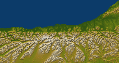
What do SALSA and the Alpine Fault have in common, you ask? Not too much, unless you fancy adding some salsa to your emergency supplies!
In this case SALSA stands for “Southern Alps Long Skinny Array” and refers to a series of seismometers recently installed along the West Coast of the South Island – from Piopiotahi Milford Sound to Maruia – stretching 500km along the straight (skinny) part of the Alpine Fault. In late 2021, scientists from Te Herenga Waka – Victoria University Wellington, SeismoCity and GNS Science installed ~50 seismometers, ~10kms apart along the Alpine Fault to increase our ability to monitor, measure, study and learn more about how seismic waves move through the earth. This will increase our understanding of what the shaking from the next large Alpine Fault earthquake will feel like.
A fundamental challenge to understanding the impacts of a large Alpine Fault earthquake is determining how parts of the fault are being stressed, and how the ground will shake throughout south and central New Zealand when the earthquake inevitably occurs. This is the first time so many seismometers have been installed with regular spacing along the onshore length of the Alpine Fault. However, the SALSA seismometers are not designed to provide data in real time. GeoNet has sensors installed permanently for that, you can see them HERE by selecting “Strong Motion Sensor”.
“Once we have collected all the data, we can examine the characteristics of very small earthquakes and consider what they tell us about future large earthquakes and how the three-dimensional geological structure of the South Island affects earthquake shaking.” Prof. John Townend – SALSA project co-lead.
In contrast, the SALSA seismometers will only be installed for 18 months, and the data will be retrieved manually every six months. It will be analysed to work out where small earthquakes are currently occurring and how movement on any portion of the fault will affect different parts of the South Island. The project will examine what the locations of small earthquakes can tell us about future large earthquakes, and how the three-dimensional geological structure of the South Island affects earthquake shaking. This will provide robust estimates of the shaking that will occur in future large Alpine Fault earthquakes.
At each SALSA site, the team has installed a seismometer attached to a datalogger, GPS sensor, and solar power system. Each seismometer is buried in a shallow hole (30–100 cm deep and approximately 50 cm in diameter) resting on a thin layer of clean washed sand and a paving stone and attached via a cable to the recording unit, which is mounted with the other components in an aluminium frame. The recording unit and battery are housed within a waterproof plastic or metal box; the GPS antenna and solar panel are attached to the aluminium frame. The frame is bolted to waratahs or pegs to ensure it withstands wind and snow loads.
On farmland, the equipment is surrounded by a fence to prevent stock damage. At most other sites, the equipment is wrapped in wire mesh and all cables are buried and protected by plastic conduit so that kea don’t interfere with the equipment.
This project involves scientists and graduate students from Victoria University of Wellington—Te Herenga Waka, SeismoCity Ltd., GNS Science, the University of Auckland, and the universities of Edinburgh, Tokyo and Washington. It is led by Professor John Townend of Victoria University of Wellington and Dr Caroline Holden of SeismoCity Ltd.
SALSA is a three-year project funded in 2020 by the Marsden Fund of the Royal Society Te Apārangi following an extensive review process. Since then, consultation has been had with papatīpu rūnanga, Te Rūnanga o Ngāti Waewae and Te Rūnaka o Makaawhio, and with the Department of Conservation.
The safety of Aotearoa New Zealand’s hydro scheme dams in the face of a large Alpine Fault earthquake is a recurring concern raised at many AF8 Roadshow events. We talked to a chief engineer at Meridian Energy about dam safety.
Magnificent mountains with precipitous snowy peaks may be what Te Tai Poutini, the West Coast of Te Waipounamu, the South Island of Aotearoa, is most famous for. But the flatter land at the foot of the mountains is what’s most valuable to residents, farmers, and travellers of the West Coast. A paper by Kiwi earth scientists highlights the landscape changes expected for this precious, habitable land after large earthquakes.
We are seeking expressions of interest for the newly vacant Science Lead position. The AF8 Programme is seeking a suitably qualified scientist with active Alpine Fault hazard and risk-related research, and strong networks and connections across the science and emergency management sectors.